Arizona - Gila County - Historic Districts
Gila County Arizona (Historic Districts) has 8 places on the National Register of Historic Places including 2 places of National significance and 4 places of Statewide significance. Significant places include Kinishba Ruins, Tonto National Monument Archeological District, Globe Commercial and Civic Historic District, Globe Downtown Historic District and Rye Creek Ruin Platform Mound Complex Archeological District.

Prehistoric cultural affiliation(s) include Mogollon, Anasazi, Salado, Archaic Native American and Apache-Yavapai dating back to 4999 BC.

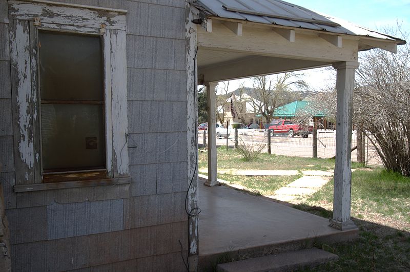
Some of the country's most noteable architects helped create the Gila County places including Trost & Trost, Lescher & Mahoney, W.R. Norton and John Bowler. Prominent architectural styles found in Gila Country are Art Deco, Bungalow/Craftsman and Classical Revival.

Globe Commercial and Civic Historic District (added 1986 - - #86002087)
Roughly along N. Broad St. from Willow St. to Tebbs St. , Globe
send us a photo to share
Historic Significance:
Event, Architecture/Engineering
Architect, builder, or engineer:
Trost & Trost, Norton,W.R.
Architectural Style:
Other, Classical Revival, Late Gothic Revival
Area of Significance:
Architecture, Commerce
Period of Significance:
1925-1949, 1900-1924, 1875-1899
Owner:
Private, Federal, Local
Historic Function:
Commerce/Trade, Government
Current Function:
Commerce/Trade, Government
Globe Downtown Historic District (added 1987 - - #87000862)
Also known as See Also:85003106,77000234,83003448,75000347
Broad St. between Cedar and Tebbs , Globe
Nyttend, CC BY 2.0, via Wikimedia Commons
Historic Significance:
Event, Architecture/Engineering
Architect, builder, or engineer:
Trost & Trost, Lescher & Mahoney
Architectural Style:
Romanesque, Late 19th And 20th Century Revivals, Art Deco
Area of Significance:
Politics/Government, Commerce, Architecture
Period of Significance:
1925-1949, 1900-1924, 1875-1899
Owner:
Private, Local
Historic Function:
Commerce/Trade, Domestic, Religion
Historic Sub-function:
Business, Hotel, Religious Structure, Specialty Store
Current Function:
Commerce/Trade, Domestic, Religion
Current Sub-function:
Business, Hotel, Religious Structure, Specialty Store
Kinishba Ruins (added 1966 - - #66000180)
Address Restricted , Whiteriver
Tillman, Public domain, via Wikimedia Commons
Historic Significance:
Information Potential, Architecture/Engineering
Architect, builder, or engineer:
Unknown
Architectural Style:
No Style Listed
Area of Significance:
Prehistoric, Architecture
Cultural Affiliation:
Mogollon, Anasazi
Period of Significance:
1499-1000 AD
Owner:
Private
Historic Function:
Domestic
Historic Sub-function:
Village Site
Current Function:
Agriculture/Subsistence
Current Sub-function:
Agricultural Fields
Pine Community Center Historic District (added 2005 - - #05000068)
Also known as Pine LDS Ward Chapel; Cultural Hall, Pine Elementary School
Bounded by Randall Dr., AZ 87/260, unnamed service Rd., and Pine Creek Dr. , Pine
Cogdog, CC BY-SA 3.0, via Wikimedia Commons
Historic Significance:
Event
Area of Significance:
Social History, Education
Period of Significance:
1950-1974, 1925-1949, 1900-1924
Owner:
Local
Historic Function:
Education, Religion, Social
Historic Sub-function:
Meeting Hall, Religious Structure, School
Current Function:
Recreation And Culture, Social
Current Sub-function:
Civic, Meeting Hall, Museum
Pine Historic District (added 1997 - - #97000909)
Also known as Pine Creek Townsite
Roughly bounded by Bradshaw , Brown, Blackburn, Pine Creek Canyon Drs., Pine Cr., and Camp Lo-Mia , Pine
send us a photo to share
Historic Significance:
Event, Architecture/Engineering
Architectural Style:
Bungalow/Craftsman
Area of Significance:
Exploration/Settlement, Community Planning And Development, Social History, Architecture
Period of Significance:
1925-1949, 1900-1924, 1875-1899
Owner:
Private, Local
Historic Function:
Domestic
Historic Sub-function:
Camp, Hotel, Single Dwelling, Village Site
Current Function:
Commerce/Trade, Domestic, Social
Current Sub-function:
Meeting Hall, Single Dwelling, Specialty Store, Village Site
Rye Creek Ruin Platform Mound Complex Archeological District (added 1995 - - #95001311)
Also known as AR-03-12-06-54,AZ 0:15:1 (Arizona State Museum),AZ 0:15:66 (
Address Restricted , Rye
send us a photo to share
Historic Significance:
Information Potential
Area of Significance:
Prehistoric
Cultural Affiliation:
Salado
Period of Significance:
1900-1750 AD, 1749-1500 AD, 1499-1000 AD, 1000-500 AD
Owner:
Federal
Historic Function:
Domestic
Historic Sub-function:
Village Site
Current Function:
Vacant/Not In Use
Theodore Roosevelt Dam National Register District (added 1998 - - #98000144)
Linear area along the Shore of Lake Roosevelt, from Dam to Canal intake , Roosevelt
Bgag, CC BY-SA 3.0, via Wikimedia Commons
Historic Significance:
Information Potential, Event
Area of Significance:
Native American, Engineering, Historic - Aboriginal, Historic - Non-Aboriginal
Cultural Affiliation:
Apache (Western)
Period of Significance:
1900-1924
Owner:
Federal
Historic Function:
Domestic, Funerary, Government, Industry/Processing/Extraction
Historic Sub-function:
Camp, Cemetery, Energy Facility, Government Office, Manufacturing Facility, Water Works
Current Function:
Domestic, Funerary, Industry/Processing/Extraction, Other, Social
Current Sub-function:
Camp, Cemetery, Clubhouse, Energy Facility
Tonto National Monument Archeological District (added 1966 - - #66000081)
Address Restricted , Roosevelt
Rotatebot, Public domain, via Wikimedia Commons
Historic Significance:
Information Potential
Area of Significance:
Historic - Non-Aboriginal, Prehistoric, Historic - Aboriginal
Cultural Affiliation:
Archaic Native American, Salado, Apache-Yavapai
Period of Significance:
500-999 BC, 499-0 BC, 3000-4999 BC, 1900-1924, 1750-1799, 1700-1749, 1499-1000 AD, 1000-2999 BC
Owner:
Federal
Historic Function:
Domestic, Funerary
Historic Sub-function:
Graves/Burials, Multiple Dwelling, Secondary Structure
Current Function:
Landscape
Current Sub-function:
Park
Return to Top
Select a Different Arizona County (map)
Apache
Cochise
Coconino
Gila
Graham
Greenlee
La Paz
Maricopa
Mohave
Navajo
Pima
Pinal
Santa Cruz
Yavapai
Yuma
Select a Different State (map)
Alabama
Alaska
Arizona
Arkansas
California
Colorado
Connecticut
Delaware
District Of Columbia
Florida
Georgia
Hawaii
Idaho
Illinois
Indiana
Iowa
Kansas
Kentucky
Louisiana
Maine
Maryland
Massachusetts
Michigan
Minnesota
Mississippi
Missouri
Montana
Nebraska
Nevada
New Hampshire
New Jersey
New Mexico
New York
North Carolina
North Dakota
Ohio
Oklahoma
Oregon
Pennsylvania
Rhode Island
South Carolina
South Dakota
Tennessee
Texas
Utah
Vermont
Virginia
Washington
West Virginia
Wisconsin
Wyoming
Return to Home Page