Arkansas - Poinsett County - Historic Districts
Poinsett County Arkansas (Historic Districts) has 6 places on the National Register of Historic Places including 2 places of National significance. Significant places include Marked Tree Lock and Siphons and Tyronza Commercial Historic District, Harrisburg Commercial Historic District, Highway A-7, Bridges Historic District and Lepanto Commercial Historic District.

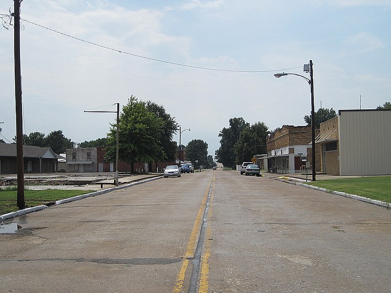
Some of the country's most noteable architects helped create the Poinsett County places including US Army Corps of Engineers, H.A. Lesmeister, V.W. Clanton, Mitchell Selligman, Riherd, Leslie and Rev.. Prominent architectural styles found in Poinsett Country are Early Commercial, Classical Revival and Art Deco.

Harrisburg Commercial Historic District (added 2009 - - #09000736)
Roughly bounded by Jackson, Water, South & Gould Sts. , Harrisburg
DoxTxob, CC BY-SA 3.0, via Wikimedia Commons
Historic Significance:
Event
Area of Significance:
Architecture
Period of Significance:
1950-1974, 1925-1949, 1900-1924, 1875-1899
Owner:
Private, Local
Historic Function:
Commerce/Trade, Commerce/Trade, Commerce/Trade, Commerce/Trade, Government, Government, Recreation And Culture
Historic Sub-function:
Business, Courthouse, Post Office, Professional, Restaurant, Specialty Store, Theater
Current Function:
Commerce/Trade, Commerce/Trade, Commerce/Trade, Commerce/Trade, Government, Government, Health Care
Current Sub-function:
Business, Courthouse, Department Store, Fire Station, Hospital, Professional, Specialty Store
Highway A-7, Bridges Historic District (added 2009 - - #09000318)
Also known as Sites #PO0073-PO0075, Bridge #580
old US 63 over Ditch No. 1 and its reliefs , Marked Tree
Colinhester, CC BY-SA 4.0, via Wikimedia Commons
Historic Significance:
Architecture/Engineering, Event
Architect, builder, or engineer:
Clanton, V.W.
Architectural Style:
Other
Area of Significance:
Transportation, Engineering
Period of Significance:
1950-1974, 1925-1949, 1900-1924
Owner:
Local
Historic Function:
Transportation
Historic Sub-function:
Road-Related
Current Function:
Transportation
Current Sub-function:
Road-Related
Lepanto Commercial Historic District (added 2009 - - #09000743)
Roughly bounded by Holmes St., Little R., Dewey St. & Alexander Ave. , Lepanto
DoxTxob, CC BY-SA 3.0, via Wikimedia Commons
Historic Significance:
Event
Area of Significance:
Commerce
Period of Significance:
1950-1974, 1925-1949, 1900-1924
Owner:
Private, Local
Historic Function:
Commerce/Trade, Commerce/Trade, Commerce/Trade, Commerce/Trade, Recreation And Culture
Historic Sub-function:
Business, Professional, Restaurant, Specialty Store, Theater
Current Function:
Commerce/Trade, Commerce/Trade, Commerce/Trade, Education
Current Sub-function:
Library, Multiple Dwelling, Single Dwelling, Specialty Store
Marked Tree Commercial Historic District (added 2009 - - #09000735)
Elm St. between Liberty & Frisco Sts.; Frisco St. between Elm and Nathan Sts. , Marked Tree
Colinhester, CC BY-SA 4.0, via Wikimedia Commons
Historic Significance:
Event
Area of Significance:
Commerce
Period of Significance:
1950-1974, 1925-1949, 1900-1924
Owner:
Private, Local
Historic Function:
Commerce/Trade, Commerce/Trade, Commerce/Trade, Commerce/Trade, Commerce/Trade, Government, Recreation And Culture
Historic Sub-function:
Business, Department Store, Post Office, Professional, Restaurant, Specialty Store, Theater
Current Function:
Commerce/Trade, Commerce/Trade, Commerce/Trade, Government
Current Sub-function:
Business, Government Office, Professional, Specialty Store
Marked Tree Lock and Siphons (added 1988 - - #88000431)
Also known as St. Francis River Lock and Siphons
On the St. Francis River , Marked Tree
DoxTxob, CC BY-SA 3.0, via Wikimedia Commons
Historic Significance:
Event, Architecture/Engineering
Architect, builder, or engineer:
Et al., US Army Corps of Engineers
Architectural Style:
No Style Listed
Area of Significance:
Engineering, Transportation
Period of Significance:
1925-1949
Owner:
Local
Historic Function:
Government, Other, Transportation
Historic Sub-function:
Public Works, Water-Related
Current Function:
Government, Other, Vacant/Not In Use
Current Sub-function:
Public Works
Tyronza Commercial Historic District (added 2009 - - #09000896)
Also known as Site #PO0078
S. Main St. bounded on the N. by Old U.S. Hwy 63 and on the S. by Mullins St. , Tyronza
DoxTxob, CC BY-SA 3.0, via Wikimedia Commons
Historic Significance:
Event
Area of Significance:
Social History, Commerce
Period of Significance:
1950-1974, 1925-1949, 1900-1924
Owner:
Private, Local
Historic Function:
Agriculture/Subsistence, Commerce/Trade, Government, Landscape, Social
Historic Sub-function:
City Hall, Financial Institution, Meeting Hall, Park, Post Office, Specialty Store, Storage
Current Function:
Agriculture/Subsistence, Commerce/Trade, Government, Landscape, Recreation And Culture, Religion
Current Sub-function:
City Hall, Museum, Park, Professional, Religious Structure, Specialty Store, Storage
Return to Top
Select a Different Arkansas County (map)
Arkansas
Ashley
Baxter
Benton
Boone
Bradley
Carroll
Chicot
Clark
Clay
Cleburne
Cleveland
Columbia
Conway
Craighead
Crittenden
Cross
Dallas
Desha
Drew
Faulkner
Franklin
Garland
Greene
Hempstead
Hot Spring
Howard
Independence
Izard
Jackson
Jefferson
Johnson
Lawrence
Lee
Lincoln
Little River
Logan
Lonoke
Madison
Marion
Miller
Mississippi
Monroe
Montgomery
Nevada
Newton
Ouachita
Perry
Phillips
Poinsett
Polk
Pope
Pulaski
Randolph
Saline
Scott
Searcy
Sebastian
Sevier
Sharp
Stone
Union
Van Buren
Washington
White
Woodruff
Yell
Select a Different State (map)
Alabama
Alaska
Arizona
Arkansas
California
Colorado
Connecticut
Delaware
District Of Columbia
Florida
Georgia
Hawaii
Idaho
Illinois
Indiana
Iowa
Kansas
Kentucky
Louisiana
Maine
Maryland
Massachusetts
Michigan
Minnesota
Mississippi
Missouri
Montana
Nebraska
Nevada
New Hampshire
New Jersey
New Mexico
New York
North Carolina
North Dakota
Ohio
Oklahoma
Oregon
Pennsylvania
Rhode Island
South Carolina
South Dakota
Tennessee
Texas
Utah
Vermont
Virginia
Washington
West Virginia
Wisconsin
Wyoming
Return to Home Page