Ohio - Cuyahoga County - Historic Districts
Cuyahoga County Ohio (Historic Districts) has 50 places on the National Register of Historic Places including 1 place of National significance and 5 places of Statewide significance. Significant places include Cleveland Mall, Birdtown Historic District, Cleveland Public Square, Cleveland Warehouse District and Cooley Farms.

Several famous people are associated with these Cuyahoga County historic places including Elizabeth B. Blossom and Elmer Sperry.

Some of the country's most noteable architects helped create the Cuyahoga County places including J. Milton Dyer, J.C. Hamilton, Herman N. Matzen, Walker & Weeks, Barton R. Deming, Meyer Altschuld, Grieble, George A.,, J.W. Hradek, Albert Davis Taylor and H.O. Fullerton. Prominent architectural styles found in Cuyahoga Country are Late 19th And 20th Century Revivals, Late Victorian and Late 19th And Early 20th Century American Movements.

Ambler Heights Historic District (added 2002 - - #02000883)
Also known as Chestnut Hills
Roughly bounded by Martin Luther King, Jr. Blvd., Cedar Clen, N. Park Blvd., and along Harcourt Dr. , Cleveland Heights
Tim1965, CC BY-SA 3.0, via Wikimedia Commons
Historic Significance:
Event, Architecture/Engineering
Architect, builder, or engineer:
Meade and Hamilton, et.al.
Architectural Style:
Late 19th And 20th Century Revivals, Late 19th And Early 20th Century American Movements
Area of Significance:
Architecture, Community Planning And Development
Period of Significance:
1925-1949, 1900-1924, 1875-1899
Owner:
Private
Historic Function:
Domestic
Historic Sub-function:
Secondary Structure, Single Dwelling
Current Function:
Domestic
Current Sub-function:
Multiple Dwelling, Secondary Structure, Single Dwelling
Ansel Road Apartment Buildings Historic District (added 2008 - - #08000589)
1588 Ansel Rd to 9501 Wade Park Ave , Cleveland
Tim1965, CC BY 2.0, via Wikimedia Commons
Historic Significance:
Event, Architecture/Engineering
Architect, builder, or engineer:
Herbert, Beidler, et al.
Architectural Style:
Mission/Spanish Revival, Colonial Revival
Area of Significance:
Architecture, Social History
Period of Significance:
1925-1949, 1900-1924
Owner:
Private
Historic Function:
Domestic
Historic Sub-function:
Multiple Dwelling
Current Function:
Domestic
Current Sub-function:
Multiple Dwelling
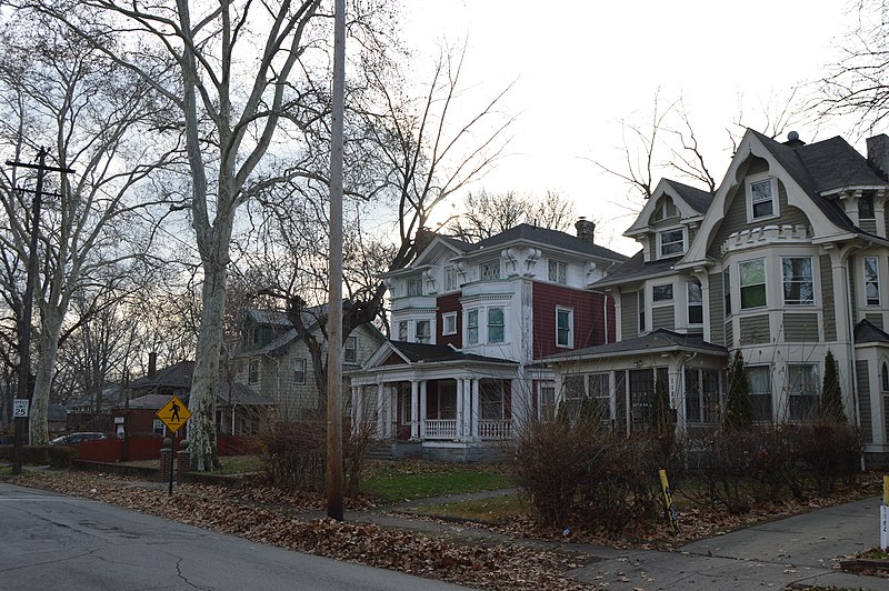
Archwood Avenue Historic District (added 1987 - - #87000428)
Archwood Ave. roughly bounded by W. Thirty-first Pl. and W. Thirty-seventh St. , Cleveland
Tim1965, CC BY 2.0, via Wikimedia Commons
Historic Significance:
Architecture/Engineering
Architect, builder, or engineer:
Unknown
Architectural Style:
Colonial Revival, Italianate, Queen Anne
Area of Significance:
Architecture
Period of Significance:
1925-1949, 1900-1924, 1875-1899, 1850-1874
Owner:
Private
Historic Function:
Domestic
Historic Sub-function:
Single Dwelling
Current Function:
Domestic
Current Sub-function:
Single Dwelling
Baldwin--Wallace College North Campus Historic District (added 2013 - - #12001210)
Bounded by Bagley & E. 5th Aves., Front & Beech Sts., Berea
Pwojdacz, CC BY-SA 3.0, via Wikimedia Commons
Historic Significance:
Event, Architecture/Engineering
Architect, builder, or engineer:
Kiekheim;Olsen;Hine,Mellenbrook, Crider & Williamson, Foley et al.
Architectural Style:
Late Victorian, Late 19th And 20th Century Revivals
Area of Significance:
Architecture, Education
Period of Significance:
1950-1974, 1925-1949, 1900-1924, 1875-1899
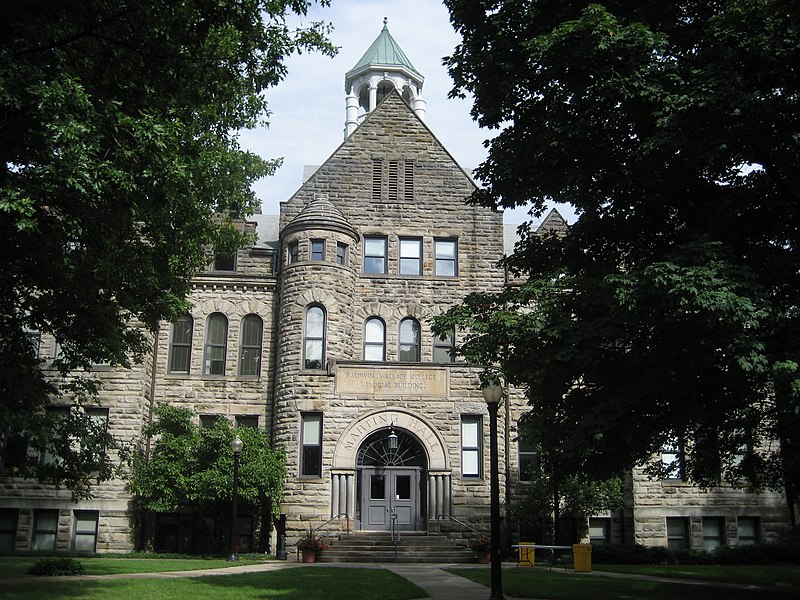
Baldwin-Wallace College South Campus Historic District (added 2010 - - #10000315)
Also known as Lyceum Village Square and German Wallace College
Seminary St between School and Church Front to Beach, variable W/E boundary , Berea
IronGargoyle, CC BY-SA 3.0, via Wikimedia Commons
Historic Significance:
Event, Architecture/Engineering
Architect, builder, or engineer:
Fugman, Godfrey, et al.
Architectural Style:
Late Victorian, Mid 19th Century Revival
Area of Significance:
Architecture, Religion, Education
Period of Significance:
1950-1974, 1925-1949, 1900-1924, 1875-1899, 1850-1874
Owner:
Private
Historic Function:
Domestic, Education, Recreation And Culture, Religion
Historic Sub-function:
College, Educational Related Housing, Library, Music Facility, Religious Structure, Single Dwelling, Sport Facility
Current Function:
Education, Recreation And Culture, Religion
Current Sub-function:
College, Educational Related Housing, Library, Music Facility, Religious Structure, Sport Facility
Bedford Historic District (added 2004 - - #04000712)
Also known as Village of Bedford, Bedford on Tinkers Creek
Roughly bounded by Willis St., Franklin St., Broadway Ave., and columbus Rd. , Bedford
Bennett-ne, CC BY-SA 3.0, via Wikimedia Commons
Historic Significance:
Event, Architecture/Engineering
Architectural Style:
Second Empire, Federal
Area of Significance:
Transportation, Commerce, Architecture
Period of Significance:
1950-1974, 1925-1949, 1900-1924, 1875-1899, 1850-1874, 1825-1849
Owner:
Local, Private
Historic Function:
Commerce/Trade, Domestic, Government, Industry/Processing/Extraction, Recreation And Culture, Religion, Social
Historic Sub-function:
Business, Financial Institution, Professional, Restaurant, Secondary Structure, Single Dwelling, Specialty Store
Current Function:
Commerce/Trade, Domestic, Health Care, Industry/Processing/Extraction, Landscape, Recreation And Culture, Religion
Current Sub-function:
Business, Financial Institution, Professional, Restaurant, Secondary Structure, Single Dwelling, Specialty Store
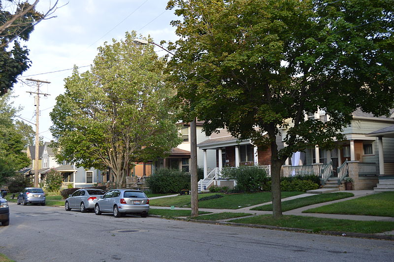
Birdtown Historic District (added 2007 - - #07000634)
Roughly bounded by Magee Rd., Plover Rd., Halstead Rd., and Madison Ave. , Lakewood
Nyttend, Public domain, via Wikimedia Commons
Historic Significance:
Event, Architecture/Engineering
Architectural Style:
Queen Anne, Bungalow/Craftsman
Area of Significance:
Industry, Architecture, European
Period of Significance:
1925-1949, 1900-1924, 1875-1899
Owner:
Private
Historic Function:
Commerce/Trade, Domestic, Education, Religion, Social
Historic Sub-function:
Business, Civic, Financial Institution, Multiple Dwelling, Religious Structure, School, Single Dwelling
Current Function:
Commerce/Trade, Domestic, Education, Religion, Social
Current Sub-function:
Business, Civic, Financial Institution, Multiple Dwelling, Religious Structure, School, Single Dwelling
Blossom, Elizabeth B., Subdivision Historic District (added 1987 - - #87001543)
Also known as See Also:Hanger, The
Jct. of Richmond and Cedar Rds. , Beachwood
Nyttend, Public domain, via Wikimedia Commons
Historic Significance:
Event, Person, Architecture/Engineering
Architect, builder, or engineer:
Harrison,Ethylwyn, Et al.
Architectural Style:
Colonial Revival
Historic Person:
Blossom,Elizabeth B.,et al.
Significant Year:
1942, 1932
Area of Significance:
Landscape Architecture, Social History
Period of Significance:
1925-1949
Owner:
Private
Historic Function:
Domestic, Landscape, Recreation And Culture
Historic Sub-function:
Outdoor Recreation, Park, Single Dwelling
Current Function:
Domestic, Landscape, Recreation And Culture
Current Sub-function:
Outdoor Recreation, Park, Single Dwelling
Broadway Avenue Historic District (added 1988 - - #88001860)
Also known as See Also:Hruby Conservatory of Music
Broadway and Hamlet Aves. and E. Fifty-fifth St. , Cleveland
Tim1965, CC BY 2.0, via Wikimedia Commons
Historic Significance:
Event, Architecture/Engineering
Architect, builder, or engineer:
Hradek,J.W., Et al.
Architectural Style:
Late 19th And 20th Century Revivals, Late Victorian
Area of Significance:
European, Architecture
Period of Significance:
1925-1949, 1900-1924, 1875-1899
Owner:
Local, Private
Historic Function:
Commerce/Trade
Historic Sub-function:
Business, Financial Institution
Current Function:
Commerce/Trade
Current Sub-function:
Business, Financial Institution
Brooklyn Centre Historic District (added 1999 - - #99000238)
Roughly bounded by I-71, Pearl Rd., and Big Creek Valley , Cleveland
Cricchetti, CC BY-SA 3.0, via Wikimedia Commons
Historic Significance:
Architecture/Engineering, Event
Architectural Style:
Gothic Revival, Greek Revival
Area of Significance:
Architecture, Community Planning And Development, Exploration/Settlement
Period of Significance:
1925-1949, 1900-1924, 1875-1899, 1850-1874, 1825-1849
Owner:
Private
Historic Function:
Commerce/Trade, Domestic, Religion
Historic Sub-function:
Business, Multiple Dwelling, Organizational, Religious Structure, Secondary Structure, Single Dwelling
Current Function:
Commerce/Trade, Domestic, Religion
Current Sub-function:
Business, Multiple Dwelling, Organizational, Religious Structure, Secondary Structure, Single Dwelling
Carroll, John, University North Quad Historic District (added 2013 - - #12001211)
1 John Carroll Blvd., University Heights
Wilson Delgado~commonswiki, Public domain, via Wikimedia Commons
Historic Significance:
Event
Area of Significance:
Community Planning And Development, Education
Period of Significance:
1950-1974, 1925-1949
Chagrin Falls East Side Historic District (added 2013 - - #13000387)
E. Washington & Philomethian Sts., Chagrin Falls
Nyttend, Public domain, via Wikimedia Commons
Historic Significance:
Architecture/Engineering
Architect, builder, or engineer:
Hutchings, W.; O'Malley, J.; Giles,C, Lowrie, A.W.; Rowe & Giles
Architectural Style:
Late Victorian, Late 19th And Early 20th Century American Movements
Area of Significance:
Architecture
Period of Significance:
1900-1924, 1875-1899, 1850-1874, 1825-1849
Chagrin Falls Triangle Park Commercial District (added 1978 - - #78002036)
Also known as See Also:Chagrin Falls Township Hall
Main, Franklin, and Washington Sts. , Chagrin Falls
Nyttend, Public domain, via Wikimedia Commons
Historic Significance:
Event, Architecture/Engineering
Architect, builder, or engineer:
multiple
Architectural Style:
Late 19th And 20th Century Revivals, Late Victorian
Area of Significance:
Architecture, Commerce, Community Planning And Development
Period of Significance:
1925-1949, 1900-1924, 1875-1899, 1850-1874, 1825-1849
Owner:
Local, Private
Historic Function:
Commerce/Trade
Historic Sub-function:
Specialty Store
Current Function:
Commerce/Trade
Current Sub-function:
Specialty Store
Chagrin Falls Triangle Park Commercial District (Boundary Increase) (added 1995 - - #95000634)
Also known as See Also:Chagrin Falls Triangle Park Commercial District
Jct. of N. Main and E. Orange Sts., extending E and S , Chagrin Falls
send us a photo to share
Historic Significance:
Event
Area of Significance:
Commerce
Period of Significance:
1925-1949, 1900-1924, 1875-1899, 1850-1874, 1825-1849
Owner:
Private
Historic Function:
Agriculture/Subsistence, Commerce/Trade, Domestic, Social, Transportation
Historic Sub-function:
Meeting Hall, Pedestrian Related, Processing, Single Dwelling, Specialty Store
Current Function:
Commerce/Trade, Transportation
Current Sub-function:
Pedestrian Related, Specialty Store
Chagrin Falls West Side District (added 1974 - - #74001433)
Bounded by W. Washington, Church, Maple, and Franklin Sts. , Chagrin Falls
Nyttend, Public domain, via Wikimedia Commons
Historic Significance:
Event, Architecture/Engineering
Architect, builder, or engineer:
multiple
Architectural Style:
Mid 19th Century Revival, Late Victorian
Area of Significance:
Social History, Architecture
Period of Significance:
1900-1924, 1875-1899, 1850-1874, 1825-1849
Owner:
Local, Private
Historic Function:
Domestic, Industry/Processing/Extraction
Historic Sub-function:
Manufacturing Facility, Single Dwelling
Current Function:
Domestic
Current Sub-function:
Single Dwelling
Cleveland Centre Historic District (added 2014 - - #13001117)
Cleveland, Cleveland
Nyttend, Public domain, via Wikimedia Commons
Cleveland Mall (added 1975 - - #75001360)
Also known as Cleveland Group Plan Historic District
Roughly T-shaped mall area between E. 9th and W. 3rd Sts. , Cleveland
Nyttend, CC BY 2.0, via Wikimedia Commons
Historic Significance:
Architecture/Engineering
Architect, builder, or engineer:
multiple
Architectural Style:
Beaux Arts
Area of Significance:
Art, Architecture, Community Planning And Development
Period of Significance:
1925-1949, 1900-1924
Owner:
Federal, Local
Historic Function:
Education, Government, Landscape
Historic Sub-function:
City Hall, Courthouse, Government Office, Library, Park, Post Office, Street Furniture/Object
Current Function:
Education, Government, Landscape
Current Sub-function:
City Hall, Courthouse, Government Office, Library, Park, Street Furniture/Object
Cleveland Public Square (added 1975 - - #75001361)
Superior Ave. and Ontario St. , Cleveland
EurekaLott, CC BY 2.0, via Wikimedia Commons
Historic Significance:
Architecture/Engineering
Architect, builder, or engineer:
Matzen,Herman N., Hamilton,J.C.
Architectural Style:
No Style Listed
Area of Significance:
Art, Architecture, Community Planning And Development
Period of Significance:
1900-1924, 1875-1899, 1750-1799
Owner:
Local
Historic Function:
Landscape, Recreation And Culture
Historic Sub-function:
Monument/Marker, Plaza
Current Function:
Landscape, Recreation And Culture
Current Sub-function:
Monument/Marker, Plaza
Cleveland Warehouse District (added 1982 - - #82003558)
Roughly bounded by Front and Superior Aves., Railroad, Summit, 3rd, and 10th Sts. , Cleveland
Historic Significance:
Architecture/Engineering, Event
Architect, builder, or engineer:
Unknown
Architectural Style:
Early Commercial, Italianate
Area of Significance:
Architecture, Commerce, Engineering
Period of Significance:
1900-1924, 1875-1899, 1850-1874
Owner:
Private
Historic Function:
Commerce/Trade
Historic Sub-function:
Business, Restaurant, Warehouse
Current Function:
Commerce/Trade
Current Sub-function:
Business, Restaurant, Warehouse
Cleveland Warehouse Historic District (Boundary Increase) (added 2007 - - #07000070)
1384-1410 West 10th St. , Cleveland
send us a photo to share
Historic Significance:
Event, Architecture/Engineering
Architectural Style:
Early Commercial
Area of Significance:
Industry, Transportation, Commerce, Engineering, Architecture
Period of Significance:
1925-1949, 1900-1924, 1875-1899, 1850-1874, 1825-1849
Owner:
Private
Historic Function:
Commerce/Trade, Industry/Processing/Extraction
Historic Sub-function:
Business, Manufacturing Facility, Warehouse
Current Function:
Commerce/Trade
Current Sub-function:
Business, Restaurant
Clifton Park Lakefront District (added 1974 - - #74001459)
Roughly bounded by Clifton Blvd., Rocky River, Lake Erie, and Webb Rd. , Lakewood
Nyttend, Public domain, via Wikimedia Commons
Historic Significance:
Person, Architecture/Engineering
Architect, builder, or engineer:
Unknown
Architectural Style:
Other, Shingle Style, Classical Revival
Historic Person:
Sperry,Elmer,et al.
Area of Significance:
Community Planning And Development, Architecture
Period of Significance:
1875-1899, 1850-1874
Owner:
Private
Historic Function:
Domestic
Historic Sub-function:
Single Dwelling
Current Function:
Domestic
Current Sub-function:
Single Dwelling
Cooley Farms (added 1979 - - #79001823)
N of Warrensville Heights off OH 175 , Warrensville Heights
Nyttend, Public domain, via Wikimedia Commons
Historic Significance:
Architecture/Engineering, Event
Architect, builder, or engineer:
Dyer,J. Milton
Architectural Style:
Other
Area of Significance:
Politics/Government, Architecture, Community Planning And Development, Social History
Period of Significance:
1900-1924
Owner:
Local
Historic Function:
Government
Historic Sub-function:
Correctional Facility
Current Function:
Vacant/Not In Use
East 89th Street Historic District (added 1988 - - #88000678)
Also known as See Also: Bell, Dr. James, House
E. Eighty-ninth St. roughly between Chester and Hough Aves. , Cleveland
Nyttend, Public domain, via Wikimedia Commons
Historic Significance:
Architecture/Engineering
Architect, builder, or engineer:
Multiple
Architectural Style:
Colonial Revival, Italianate, Queen Anne
Area of Significance:
Architecture
Period of Significance:
1900-1924, 1875-1899
Owner:
Private
Historic Function:
Domestic
Historic Sub-function:
Single Dwelling
Current Function:
Domestic
Current Sub-function:
Single Dwelling
East Boulevard Historic District (added 1995 - - #95001366)
Roughly bounded by East Blvd., St. Clair Ave., E. 99th St. and University Cir. , Cleveland
Nyttend, Public domain, via Wikimedia Commons
Historic Significance:
Architecture/Engineering
Architect, builder, or engineer:
Hullett, R. M., et al.
Architectural Style:
Late 19th And Early 20th Century American Movements, Late 19th And 20th Century Revivals
Area of Significance:
Community Planning And Development, Landscape Architecture, Architecture
Period of Significance:
1925-1949, 1900-1924
Owner:
Local, Private
Historic Function:
Domestic, Education, Landscape, Religion
Historic Sub-function:
Institutional Housing, Multiple Dwelling, Park, Religious Structure, School, Single Dwelling
Current Function:
Domestic, Education, Landscape, Religion
Current Sub-function:
Institutional Housing, Multiple Dwelling, Park, Religious Structure, School, Single Dwelling
East Fourth Street Historic District (added 1987 - - #87001179)
Also known as See Also: Krause Building--Otto Moser's Cafe
Roughly on E. Fourth St. between Euclid and Prospect Aves. , Cleveland
FlickreviewR, CC BY 2.0, via Wikimedia Commons
Historic Significance:
Architecture/Engineering
Architect, builder, or engineer:
Unknown
Architectural Style:
No Style Listed
Area of Significance:
Architecture
Period of Significance:
1925-1949, 1900-1924, 1875-1899
Owner:
Private
Historic Function:
Commerce/Trade
Historic Sub-function:
Business, Specialty Store
Current Function:
Commerce/Trade
Current Sub-function:
Business, Specialty Store
Euclid Avenue Historic District (added 2002 - - #02000702)
Roughly bounded by Public Square, Euclid Ave. to E. 17th St., E. 21st St. , Cleveland
Flickr upload bot, CC BY 2.0, via Wikimedia Commons
Historic Significance:
Event, Architecture/Engineering
Architect, builder, or engineer:
multiple
Architectural Style:
Late 19th And 20th Century Revivals, Late 19th And Early 20th Century American Movements
Area of Significance:
Commerce, Architecture, Commerce, Transportation
Period of Significance:
1950-1974, 1925-1949, 1900-1924, 1875-1899, 1850-1874
Owner:
Local, Private
Historic Function:
Commerce/Trade, Domestic, Education, Religion, Social
Historic Sub-function:
Financial Institution, Meeting Hall, Religious Structure, School, Single Dwelling
Current Function:
Commerce/Trade, Domestic, Education, Religion, Social
Current Sub-function:
Business, Financial Institution, Meeting Hall, Religious Structure, School, Single Dwelling
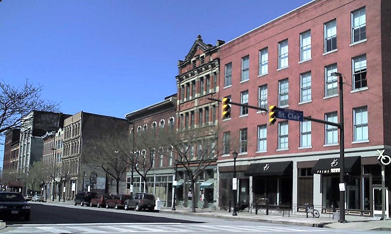
Euclid Avenue Historic District (Boundary Increase) (added 2007 - - #07000524)
205 St. Clair Ave., 1370 Ontario St., 1796-1808 E. 13th St. , Cleveland
send us a photo to share
Historic Significance:
Event, Architecture/Engineering
Architect, builder, or engineer:
Knox and Elliot, Murgatroyd, Robert and Odgen
Architectural Style:
Late 19th And Early 20th Century American Movements, Late 19th And 20th Century Revivals
Area of Significance:
Commerce, Architecture
Period of Significance:
1950-1974, 1925-1949, 1900-1924, 1875-1899, 1850-1874
Owner:
Local, Private
Historic Function:
Commerce/Trade, Domestic, Government
Historic Sub-function:
Business, Financial Institution, Hotel, Multiple Dwelling, Post Office, Professional
Current Function:
Commerce/Trade, Domestic, Government
Current Sub-function:
Business, Multiple Dwelling, Post Office, Professional
Euclid Golf Allotment (added 2002 - - #02000887)
Also known as Euclid Golf Historic District
Roughly bounded by Cedar Rd., Coventry Rd., Scarborough Rd., W. St. James Pkwy, and Ardleigh Dr. , Cleveland Heights
Nyttend, Public domain, via Wikimedia Commons
Historic Significance:
Architecture/Engineering, Event
Architect, builder, or engineer:
Deming, Barton R., et.al.
Architectural Style:
Late 19th And 20th Century Revivals, Late 19th And Early 20th Century American Movements
Area of Significance:
Architecture, Community Planning And Development
Period of Significance:
1950-1974, 1925-1949, 1900-1924
Owner:
Private
Historic Function:
Commerce/Trade, Domestic
Historic Sub-function:
Business, Multiple Dwelling, Secondary Structure, Single Dwelling
Current Function:
Commerce/Trade, Domestic
Current Sub-function:
Business, Multiple Dwelling, Secondary Structure, Single Dwelling
Euclid Heights Historic District (added 2012 - - #12000897)
Mayfield, Coventry, Cedar, Overlook, Cleveland Heights
Nyttend, Public domain, via Wikimedia Commons
Historic Significance:
Event, Architecture/Engineering
Architect, builder, or engineer:
Multiple
Architectural Style:
Late Victorian, Late 19th And 20th Century Revivals
Area of Significance:
Architecture, Community Planning And Development, Commerce
Period of Significance:
1925-1949, 1900-1924, 1875-1899
Fairhill Road Village Historic District (added 1990 - - #90000758)
12309--12511 Fairhill Rd. , Cleveland
Nyttend, Public domain, via Wikimedia Commons
Historic Significance:
Architecture/Engineering, Event
Architect, builder, or engineer:
Fullerton,H.O., Gray,A. Donald
Architectural Style:
Tudor Revival
Area of Significance:
Architecture, Landscape Architecture, Community Planning And Development
Period of Significance:
1925-1949
Owner:
Private
Historic Function:
Domestic
Historic Sub-function:
Single Dwelling
Current Function:
Domestic
Current Sub-function:
Single Dwelling
Fairmount Boulevard District (added 1976 - - #76001391)
2485--3121 Fairmount Blvd. , Cleveland Heights
Nyttend, Public domain, via Wikimedia Commons
Historic Significance:
Event, Architecture/Engineering
Architect, builder, or engineer:
Walker & Weeks, Et al.
Architectural Style:
Other, Georgian, Renaissance
Area of Significance:
Architecture, Landscape Architecture, Community Planning And Development
Period of Significance:
1900-1924, 1875-1899
Owner:
Private
Historic Function:
Domestic
Historic Sub-function:
Single Dwelling
Current Function:
Domestic
Current Sub-function:
Single Dwelling
Fairview Community Park Historic District (added 2013 - - #13000388)
21077 N. Park Dr., Fairview Park
Nyttend, Public domain, via Wikimedia Commons
Historic Significance:
Event, Architecture/Engineering
Architect, builder, or engineer:
Carr, J.J.; Potter, J.E.; CLoyd, J.R, WPA District Four; Neff, Earl
Architectural Style:
Other
Area of Significance:
Community Planning And Development, Architecture, Art
Period of Significance:
1925-1949
Forest Hill Historic District (added 1986 - - #86001662)
Roughly bounded by Glynn Rd., Northdale Blvd. and Cleviden Rd., Mt. Vernon Blvd. and Wyatt Rd., and Lee Blvd. , Cleveland
Nyttend, Public domain, via Wikimedia Commons
Historic Significance:
Architecture/Engineering
Architect, builder, or engineer:
Thomas,Andrew J.
Architectural Style:
Other, Late 19th And 20th Century Revivals
Area of Significance:
Community Planning And Development, Architecture
Period of Significance:
1925-1949
Owner:
Private
Historic Function:
Domestic
Historic Sub-function:
Single Dwelling
Current Function:
Domestic
Current Sub-function:
Single Dwelling
Forest Hill Historic District (added 1986 - - #86001662)
Roughly bounded by Glynn Rd., Northdale Blvd. and Cleviden Rd., Mt. Vernon Blvd. and Wyatt Rd., and Lee Blvd. , Cleveland Heights
Nyttend, Public domain, via Wikimedia Commons
Historic Significance:
Architecture/Engineering
Architect, builder, or engineer:
Thomas,Andrew J.
Architectural Style:
Other, Late 19th And 20th Century Revivals
Area of Significance:
Community Planning And Development, Architecture
Period of Significance:
1925-1949
Owner:
Private
Historic Function:
Domestic
Historic Sub-function:
Single Dwelling
Current Function:
Domestic
Current Sub-function:
Single Dwelling
Forest Hill Park (added 1998 - - #98000072)
Roughly along Lee Blvd., Superior, Terrace, and Mayfield Rds. , East Cleveland
Nyttend, Public domain, via Wikimedia Commons
Historic Significance:
Architecture/Engineering
Architect, builder, or engineer:
Taylor, Albert Davis
Architectural Style:
Other
Area of Significance:
Landscape Architecture
Period of Significance:
1925-1949, 1900-1924, 1875-1899
Owner:
Local
Historic Function:
Domestic, Landscape, Recreation And Culture
Historic Sub-function:
Camp, Outdoor Recreation, Park
Current Function:
Landscape, Recreation And Culture
Current Sub-function:
Outdoor Recreation, Park
Franklin Boulevard Historic District (added 1989 - - #89000430)
Also known as See Also:Tiedemann, Hannes, House
Franklin Blvd. from W. 52nd to W. 38th Sts. , Cleveland
Nyttend, Public domain, via Wikimedia Commons
Historic Significance:
Architecture/Engineering
Architect, builder, or engineer:
Multiple
Architectural Style:
Queen Anne, Italianate, Second Empire
Area of Significance:
Architecture
Period of Significance:
1900-1924, 1875-1899, 1850-1874
Owner:
Private
Historic Function:
Domestic
Historic Sub-function:
Multiple Dwelling, Single Dwelling
Current Function:
Domestic
Current Sub-function:
Multiple Dwelling, Single Dwelling
Franklin Boulevard--West Clinton Avenue Historic District (added 1993 - - #93001334)
5207--7625 Franklin Blvd., 5802-7325 W. Clinton Ave. , Cleveland
Nyttend, Public domain, via Wikimedia Commons
Historic Significance:
Architecture/Engineering
Architect, builder, or engineer:
Multiple
Architectural Style:
Late 19th And Early 20th Century American Movements, Late Victorian, Late 19th And 20th Century Revivals
Area of Significance:
Architecture
Period of Significance:
1925-1949, 1900-1924, 1875-1899
Owner:
Private
Historic Function:
Commerce/Trade, Domestic, Religion
Historic Sub-function:
Multiple Dwelling, Religious Structure, Single Dwelling, Specialty Store
Current Function:
Commerce/Trade, Domestic, Religion
Current Sub-function:
Multiple Dwelling, Religious Structure, Single Dwelling, Specialty Store
Franklin Boulevard--West Clinton Avenue Historic District (Boundary Increase) (added 2006 - - #06000269)
5207-7625 Franklin Blvd., 5802-07325 W. Clinton Ave., 6801-7003,7319-7405 Detroit Ave. , Cleveland
send us a photo to share
Historic Significance:
Architecture/Engineering
Architectural Style:
Queen Anne, Italianate
Area of Significance:
Architecture
Period of Significance:
1925-1949, 1900-1924
Owner:
Private
Historic Function:
Commerce/Trade, Domestic, Religion
Historic Sub-function:
Religious Structure, Secondary Structure, Single Dwelling, Specialty Store
Current Function:
Commerce/Trade, Domestic, Religion
Current Sub-function:
Multiple Dwelling, Religious Structure, Single Dwelling, Specialty Store
Gates Mills Historic District (added 1991 - - #91001491)
Also known as See Also:75001367;80002981;88000206;82003560
Roughly, along Berkshire, Chagrin River, Epping, Old Mill and Sherman Rds. , Gates Mills
Jf1123581321, CC BY-SA 3.0, via Wikimedia Commons
Historic Significance:
Event, Architecture/Engineering
Architect, builder, or engineer:
Multiple
Architectural Style:
Colonial Revival, Tudor Revival, Greek Revival
Area of Significance:
Agriculture, Landscape Architecture, Community Planning And Development, Architecture
Period of Significance:
1925-1949, 1900-1924, 1875-1899, 1850-1874, 1825-1849, 1800-1824
Owner:
Local, Private
Historic Function:
Agriculture/Subsistence, Domestic, Education, Government, Religion
Historic Sub-function:
City Hall, Post Office, Religious Structure, School, Single Dwelling
Current Function:
Agriculture/Subsistence, Domestic, Education, Government, Religion
Current Sub-function:
City Hall, Post Office, Religious Structure, School, Single Dwelling
Gleason, Edmund, Farm (Boundary Increase) (added 1993 - - #93000075)
Also known as NPS Tract #123-03;List of Classified Structures HS-403-407;S
7243 Canal Rd. , Valley View
send us a photo to share
Historic Significance:
Architecture/Engineering, Event
Architect, builder, or engineer:
Unknown
Architectural Style:
Other
Area of Significance:
Agriculture, Architecture
Period of Significance:
1925-1949, 1900-1924, 1875-1899, 1850-1874
Owner:
Federal
Historic Function:
Agriculture/Subsistence, Domestic
Historic Sub-function:
Agricultural Fields, Processing, Single Dwelling
Current Function:
Vacant/Not In Use
Gordon Square Historic District (added 2002 - - #02001209)
Detroit Ave. and W. 65th St. , Cleveland
Nyttend, Public domain, via Wikimedia Commons
Historic Significance:
Architecture/Engineering, Event
Architect, builder, or engineer:
et al., Grieble, George A.,
Architectural Style:
Colonial Revival
Area of Significance:
Architecture, Commerce
Period of Significance:
1925-1949, 1900-1924
Owner:
Private
Historic Function:
Commerce/Trade, Domestic, Religion
Historic Sub-function:
Department Store, Multiple Dwelling, Religious Structure, Single Dwelling
Current Function:
Commerce/Trade, Domestic, Religion
Current Sub-function:
Department Store, Multiple Dwelling, Religious Structure
Grant Deming's Forest Hill Allotment Historic District (added 2010 - - #10000189)
Also known as Cleveland Heights Realty Co. Forest Hill Subdivision No. 2, Boulevard Land & Building Co. Forest Hill Subdivision
Woodward Ave, Lincoln Blvd, Edgehill Rd, Parkway Dr, Redwood Rd,..... , Cleveland Heights
Nyttend, Public domain, via Wikimedia Commons
Historic Significance:
Event, Architecture/Engineering
Architect, builder, or engineer:
Wolf, C. Alexander, Meade & Hamilton
Architectural Style:
Late 19th And Early 20th Century American Movements, Shingle Style
Area of Significance:
Architecture, Social History, Community Planning And Development
Period of Significance:
1925-1949, 1900-1924
Owner:
Local, Private
Historic Function:
Domestic, Domestic, Domestic, Education, Landscape
Historic Sub-function:
Library, Multiple Dwelling, Natural Feature, Secondary Structure, Single Dwelling
Current Function:
Domestic, Domestic, Domestic, Education, Landscape
Current Sub-function:
Library, Multiple Dwelling, Natural Feature, Secondary Structure, Single Dwelling
Inglewood Historic District (added 2009 - - #09000210)
Also known as Shaker Heights Improvement Company Subdivision #4 & #6
Inglewood Dr., Oakridge Dr., Cleveland Heights Blvd., Yellowstone & Glenwood Rds., & Quilliams , Cleveland Heights
Tim1965, CC BY 2.0, via Wikimedia Commons
Historic Significance:
Architecture/Engineering, Event
Architect, builder, or engineer:
Walker & Weeks, et al.
Architectural Style:
Beaux Arts, Shingle Style
Area of Significance:
Architecture, Community Planning And Development, Social History
Period of Significance:
1950-1974, 1925-1949, 1900-1924
Owner:
Private
Historic Function:
Domestic
Historic Sub-function:
Secondary Structure, Single Dwelling
Current Function:
Domestic
Current Sub-function:
Secondary Structure, Single Dwelling
Irishtown Bend Archeological District (added 1990 - - #90000757)
Address Restricted , Cleveland
LeheckaG, Public domain, via Wikimedia Commons
Historic Significance:
Information Potential, Architecture/Engineering, Event
Area of Significance:
Historic - Non-Aboriginal, Economics, European, Social History, Architecture
Cultural Affiliation:
Central/Eastern European, Irish
Period of Significance:
1900-1924, 1875-1899, 1850-1874
Owner:
Local
Historic Function:
Commerce/Trade, Domestic
Historic Sub-function:
Single Dwelling, Specialty Store
Current Function:
Transportation, Vacant/Not In Use
Current Sub-function:
Road-Related
Jaite Mill Historic District (added 1979 - - #79000288)
SE of Brecksville at Riverview and Vaughan Rds. , Brecksville
Acroterion, Public domain, via Wikimedia Commons
Historic Significance:
Event
Area of Significance:
Industry
Period of Significance:
1900-1924
Owner:
Private
Historic Function:
Commerce/Trade, Domestic, Transportation
Historic Sub-function:
Rail-Related, Single Dwelling
Current Function:
Commerce/Trade, Domestic, Transportation
Current Sub-function:
Rail-Related, Single Dwelling
Jones Home Subdivisions Historic District (added 2012 - - #12000031)
Woodbridge, Marvin, Daisy, & Library Aves., & W. 25th St., Cleveland
Nyttend, Public domain, via Wikimedia Commons
Historic Significance:
Event, Architecture/Engineering
Architectural Style:
Late Victorian, Late 19th And 20th Century Revivals
Area of Significance:
Architecture, Community Planning And Development
Period of Significance:
1925-1949, 1900-1924, 1875-1899, 1850-1874
Kulas, E. J., Estate Historic District (added 1988 - - #88000206)
W. Hill Dr. , Gates Mills
Nyttend, Public domain, via Wikimedia Commons
Historic Significance:
Architecture/Engineering
Architect, builder, or engineer:
Greco,Charles R.
Architectural Style:
Tudor Revival
Area of Significance:
Architecture
Period of Significance:
1925-1949
Owner:
Private
Historic Function:
Domestic
Historic Sub-function:
Secondary Structure, Single Dwelling
Current Function:
Domestic
Current Sub-function:
Secondary Structure, Single Dwelling
Lorain Avenue Commercial Historic District (added 1994 - - #94000596)
Also known as See Also:Miller Block
3202--5730 Lorain Ave. , Cleveland
Nyttend, Public domain, via Wikimedia Commons
Historic Significance:
Event, Architecture/Engineering
Architect, builder, or engineer:
Coburn and Barnum, Mitermiler, Andrew
Architectural Style:
Queen Anne, Romanesque, Italianate
Area of Significance:
Commerce, Architecture
Period of Significance:
1925-1949, 1900-1924, 1875-1899, 1850-1874
Owner:
Private
Historic Function:
Commerce/Trade, Domestic, Recreation And Culture, Social
Historic Sub-function:
Financial Institution, Meeting Hall, Multiple Dwelling, Restaurant, Specialty Store, Theater
Current Function:
Commerce/Trade, Domestic
Current Sub-function:
Multiple Dwelling, Restaurant, Specialty Store
Lorain Station Historic District (added 1994 - - #94000417)
9005--10134 Lorain Ave. , Cleveland
Cricchetti, CC BY-SA 3.0, via Wikimedia Commons
Historic Significance:
Architecture/Engineering, Event
Architect, builder, or engineer:
Altschuld, Meyer, Bohm, Gustav B.
Architectural Style:
Queen Anne, Other, Classical Revival
Area of Significance:
Architecture, Commerce
Period of Significance:
1925-1949, 1900-1924, 1875-1899
Owner:
Private
Historic Function:
Commerce/Trade, Domestic, Transportation
Historic Sub-function:
Business, Financial Institution, Multiple Dwelling, Rail-Related, Specialty Store
Current Function:
Commerce/Trade, Domestic, Vacant/Not In Use
Current Sub-function:
Business, Multiple Dwelling, Specialty Store
Lower Prospect--Huron Historic District (added 1995 - - #94000640)
Also known as See Also:Caxton Building;Medical Centre Building;Halle Broth
Seven blocks in downtown centered around jct. of Prospect Ave., Huron Rd. and E 9th St. , Cleveland
Nyttend, Public domain, via Wikimedia Commons
Historic Significance:
Architecture/Engineering, Event
Architect, builder, or engineer:
Bacon, Henry, et al.
Architectural Style:
No Style Listed, Classical Revival, Romanesque
Area of Significance:
Architecture, Commerce
Period of Significance:
1925-1949, 1900-1924, 1875-1899
Owner:
Private
Historic Function:
Commerce/Trade, Domestic, Industry/Processing/Extraction
Historic Sub-function:
Business, Communications Facility, Department Store, Financial Institution, Hotel, Specialty Store
Current Function:
Commerce/Trade, Domestic, Industry/Processing/Extraction, Vacant/Not In Use
Current Sub-function:
Business, Communications Facility, Multiple Dwelling, Restaurant, Specialty Store
Return to Top
Select a Different Ohio County (map)
Allen
Ashland
Ashtabula
Athens
Auglaize
Belmont
Brown
Butler
Champaign
Clark
Clermont
Clinton
Columbiana
Coshocton
Crawford
Cuyahoga
Darke
Defiance
Delaware
Erie
Fairfield
Fayette
Franklin
Gallia
Geauga
Greene
Guernsey
Hamilton
Hancock
Hardin
Harrison
Highland
Hocking
Holmes
Huron
Jackson
Jefferson
Knox
Lake
Lawrence
Licking
Logan
Lorain
Lucas
Madison
Mahoning
Medina
Meigs
Mercer
Miami
Montgomery
Morgan
Muskingum
Noble
Ottawa
Perry
Pickaway
Pike
Portage
Preble
Putnam
Richland
Ross
Scioto
Seneca
Shelby
Stark
Summit
Trumbull
Tuscarawas
Union
Warren
Washington
Wayne
Williams
Wood
Wyandot
Select a Different State (map)
Alabama
Alaska
Arizona
Arkansas
California
Colorado
Connecticut
Delaware
District Of Columbia
Florida
Georgia
Hawaii
Idaho
Illinois
Indiana
Iowa
Kansas
Kentucky
Louisiana
Maine
Maryland
Massachusetts
Michigan
Minnesota
Mississippi
Missouri
Montana
Nebraska
Nevada
New Hampshire
New Jersey
New Mexico
New York
North Carolina
North Dakota
Ohio
Oklahoma
Oregon
Pennsylvania
Rhode Island
South Carolina
South Dakota
Tennessee
Texas
Utah
Vermont
Virginia
Washington
West Virginia
Wisconsin
Wyoming
Return to Home Page