Pennsylvania - Fayette County - Historic Districts
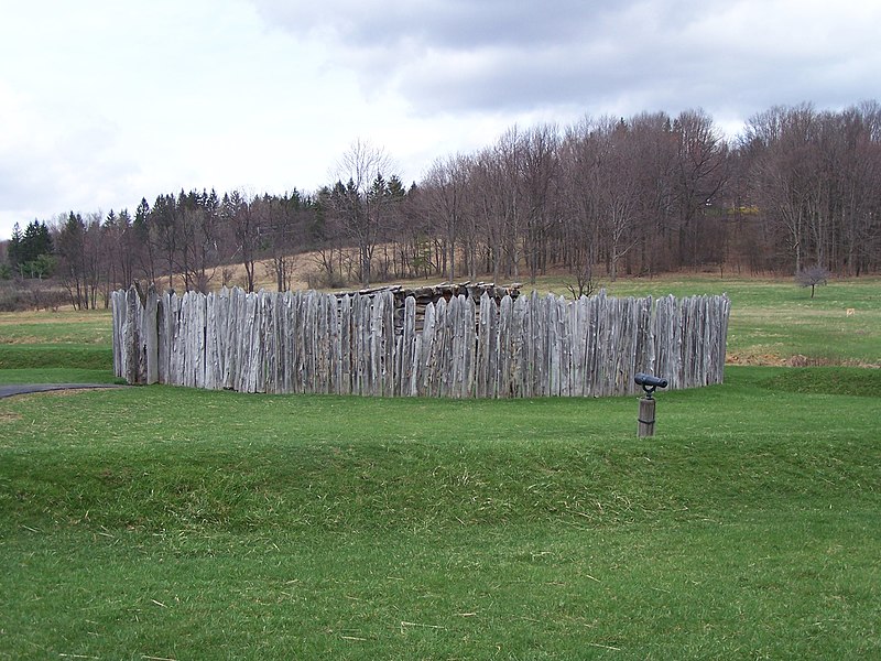
Fayette County Pennsylvania (Historic Districts) has 16 places on the National Register of Historic Places including 2 places of National significance and 3 places of Statewide significance. Significant places include Fort Necessity National Battlefield, Penn-Craft Historic District, Brier Hill, Shoaf Historic District and Smock Historic District.

The famous person George Washington is associated with one of more of the Fayette County historic places.

Some of the country's most noteable architects helped create the Fayette County places including David Day, William Macy Stanton, Pittsburg Coal Co. et al, Thomas Pringle, Thompson & Starrett, J. Edward Keirn, Washington Coal and Coke and Joseph Frankln Kuntz. Prominent architectural styles found in Fayette Country are Bungalow/Craftsman, Moderne and Classical Revival.
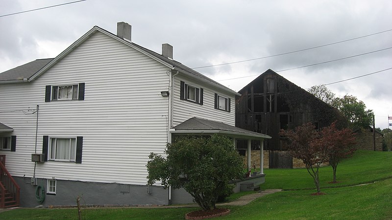
Brier Hill (added 1973 - - #73001629)
On U.S. 40 , Brier Hill
Nyttend, Public domain, via Wikimedia Commons
Historic Significance:
Architecture/Engineering, Event
Architect, builder, or engineer:
Unknown
Architectural Style:
No Style Listed
Area of Significance:
Architecture, Industry
Period of Significance:
1900-1924
Owner:
Private
Historic Function:
Domestic, Industry/Processing/Extraction
Historic Sub-function:
Extractive Facility, Single Dwelling
Current Function:
Domestic
Current Sub-function:
Single Dwelling
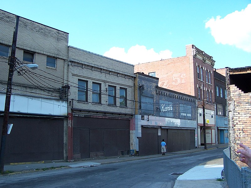
Brownsville Commercial Historic District (added 1993 - - #93000716)
Also known as See Also: Dunlap's Creek Bridge
105--128 Brownsville Ave. and 1--145 Market, 101--200 High, 2--6 Water, 100 Charles, 1 Seneca and 108 Bank Sts. , Brownsville
Breakfastchief~commonswiki, Public domain, via Wikimedia Commons
Historic Significance:
Architecture/Engineering, Event
Architect, builder, or engineer:
Multiple
Architectural Style:
Classical Revival, Italianate, Moderne
Area of Significance:
Commerce, Transportation, Architecture
Period of Significance:
1925-1949, 1900-1924, 1875-1899, 1850-1874, 1825-1849
Owner:
Federal, Private
Historic Function:
Commerce/Trade, Government, Recreation And Culture, Transportation
Historic Sub-function:
Business, City Hall, Department Store, Rail-Related, Specialty Store, Theater
Current Function:
Commerce/Trade, Domestic, Government
Current Sub-function:
City Hall, Multiple Dwelling, Post Office, Restaurant, Specialty Store, Warehouse
Brownsville Northside Historic District (added 1993 - - #93000717)
Also known as See Also: Bowman's Castle;St. Peter's Church
Roughly bounded by Front St., Broadway, Shaffner Rd. and Baltimore St. , Brownsville
Sisyphos23, Public domain, via Wikimedia Commons
Historic Significance:
Event, Architecture/Engineering
Architect, builder, or engineer:
Multiple
Architectural Style:
Colonial Revival, Bungalow/Craftsman, Greek Revival
Area of Significance:
Commerce, Architecture
Period of Significance:
1925-1949, 1900-1924, 1875-1899, 1850-1874, 1825-1849, 1800-1824, 1750-1799
Owner:
Local, Private
Historic Function:
Commerce/Trade, Domestic, Recreation And Culture
Historic Sub-function:
Department Store, Hotel, Multiple Dwelling, Secondary Structure, Single Dwelling, Specialty Store, Theater
Current Function:
Commerce/Trade, Domestic, Recreation And Culture
Current Sub-function:
Multiple Dwelling, Professional, Restaurant, Secondary Structure, Single Dwelling, Specialty Store, Theater
Dawson Historic District (added 1997 - - #97001252)
[Roughly bounded by Howell St., Middle Alley, Youghiogheny R, River Rd., and Spring, and Locust Alleys , Dawson
Canadian2006, CC BY-SA 3.0, via Wikimedia Commons
Historic Significance:
Event, Architecture/Engineering
Architect, builder, or engineer:
Pringle, Thomas
Architectural Style:
Queen Anne, Bungalow/Craftsman, Classical Revival
Area of Significance:
Industry, Architecture
Period of Significance:
1925-1949, 1900-1924, 1875-1899, 1850-1874
Owner:
Federal, Private
Historic Function:
Commerce/Trade, Domestic, Religion, Social, Transportation
Historic Sub-function:
Meeting Hall, Rail-Related, Religious Structure, Secondary Structure, Single Dwelling
Current Function:
Commerce/Trade, Domestic, Religion, Social, Vacant/Not In Use
Current Sub-function:
Meeting Hall, Religious Structure, Secondary Structure, Single Dwelling
Fort Necessity National Battlefield (added 1966 - - #66000664)
11 mi. E of Uniontown on U.S. 40 , Uniontown
OgreBot, CC BY-SA 3.0, via Wikimedia Commons
Historic Significance:
Event, Person
Historic Person:
Washington,George
Significant Year:
1755, 1754
Area of Significance:
Exploration/Settlement, Military
Period of Significance:
1750-1799
Owner:
Federal
Historic Function:
Defense
Historic Sub-function:
Battle Site
Current Function:
Landscape, Recreation And Culture
Current Sub-function:
Monument/Marker, Park
Linden Hall at Saint James Park (added 1989 - - #89001787)
Also known as Linden Hall
RR 26051 NW of Dawson , Dawson
Nyttend, CC BY 2.0, via Wikimedia Commons
Historic Significance:
Architecture/Engineering
Architect, builder, or engineer:
Thompson & Starrett, Kuntz,Joseph Frankln
Architectural Style:
Tudor Revival
Area of Significance:
Architecture
Period of Significance:
1900-1924
Owner:
Private
Historic Function:
Domestic
Historic Sub-function:
Single Dwelling
Current Function:
Domestic
Current Sub-function:
Single Dwelling
New Geneva Historic District (added 1996 - - #95000119)
Roughly bounded by Front St. E from Church Ln., Georges Cr. and the Monongahela R., Nicholson Township , New Geneva
Generic1139, CC BY-SA 3.0, via Wikimedia Commons
Historic Significance:
Event, Architecture/Engineering
Architect, builder, or engineer:
Unknown
Architectural Style:
Federal, Queen Anne
Area of Significance:
Architecture, Industry, Commerce, Transportation
Period of Significance:
1925-1949, 1900-1924, 1875-1899, 1850-1874, 1825-1849, 1800-1824, 1750-1799
Owner:
Local, Private
Historic Function:
Commerce/Trade, Domestic, Religion
Historic Sub-function:
Business, Religious Structure, Secondary Structure, Single Dwelling
Current Function:
Domestic, Religion
Current Sub-function:
Religious Structure, Secondary Structure, Single Dwelling
Newmyer, Peter and Jonathan, Farm (added 1998 - - #98000901)
3165 Richey Rd. , Bullskin Township
Generic1139, CC BY-SA 3.0, via Wikimedia Commons
Historic Significance:
Architecture/Engineering
Architectural Style:
Federal
Area of Significance:
Architecture
Period of Significance:
1925-1949, 1900-1924, 1875-1899, 1850-1874, 1825-1849, 1800-1824, 1750-1799
Owner:
Private
Historic Function:
Agriculture/Subsistence, Domestic
Historic Sub-function:
Agricultural Outbuildings, Single Dwelling
Current Function:
Agriculture/Subsistence, Domestic
Current Sub-function:
Agricultural Outbuildings, Single Dwelling
Penn-Craft Historic District (added 1989 - - #89000356)
Roughly bounded by PA 4020, Twp. Rd. 326, and Twp. Rd. 549 , Penn-Craft
Nyttend, Public domain, via Wikimedia Commons
Historic Significance:
Event
Area of Significance:
Community Planning And Development, Social History
Period of Significance:
1925-1949
Owner:
Private
Historic Function:
Commerce/Trade, Domestic, Industry/Processing/Extraction, Recreation And Culture
Historic Sub-function:
Department Store, Outdoor Recreation, Secondary Structure, Single Dwelling, Single Dwelling
Current Function:
Commerce/Trade, Domestic, Recreation And Culture
Current Sub-function:
Outdoor Recreation, Secondary Structure, Single Dwelling
Shoaf Historic District (added 1994 - - #94000518)
Also known as Shoaf No. 1
Roughly bounded by Nos. 1-170 First St., Second St., processing buildings and the bank of coke ovens, Georges Township , Shoaf
Nyttend, Public domain, via Wikimedia Commons
Historic Significance:
Architecture/Engineering, Event
Architect, builder, or engineer:
Multiple
Architectural Style:
Other
Area of Significance:
Engineering, Community Planning And Development, Industry
Period of Significance:
1925-1949, 1900-1924
Owner:
Private
Historic Function:
Domestic, Industry/Processing/Extraction
Historic Sub-function:
Extractive Facility, Hotel, Processing Site
Current Function:
Domestic, Vacant/Not In Use
Current Sub-function:
Hotel, Single Dwelling
Smock Historic District (added 1994 - - #94000520)
Roughly bounded by Redstone Cemetery, Colonial Mine No. 1, Smock Hill, Colonial Mine No. 2 and Redstone Cr. , Smock
Smallbones, CC0, via Wikimedia Commons
Historic Significance:
Architecture/Engineering, Information Potential, Event
Architect, builder, or engineer:
Pittsburg Coal Co. et al
Area of Significance:
Community Planning And Development, Historic - Non-Aboriginal, Architecture, Industry
Cultural Affiliation:
American, European
Period of Significance:
1925-1949, 1900-1924, 1875-1899
Owner:
Private
Historic Function:
Commerce/Trade, Domestic, Funerary, Industry/Processing/Extraction
Historic Sub-function:
Cemetery, Extractive Facility, Multiple Dwelling, Single Dwelling, Specialty Store
Current Function:
Commerce/Trade, Domestic, Funerary, Religion
Current Sub-function:
Cemetery, Multiple Dwelling, Religious Structure, Single Dwelling, Specialty Store
Star Junction Historic District (added 1997 - - #97001244)
Roughly the jct. of PA 51 and PA 4036, including Post Office Rd., Church St., PA 532, and Old Ridge Rd. , Perry
Nyttend, Public domain, via Wikimedia Commons
Historic Significance:
Event, Architecture/Engineering
Architect, builder, or engineer:
Washington Coal and Coke
Architectural Style:
Other
Area of Significance:
Community Planning And Development, Industry, Architecture
Period of Significance:
1925-1949, 1900-1924, 1875-1899
Owner:
Federal, Private
Historic Function:
Domestic, Industry/Processing/Extraction, Religion
Historic Sub-function:
Extractive Facility, Multiple Dwelling, Processing Site, Religious Structure, Water Works
Current Function:
Commerce/Trade, Domestic, Government, Industry/Processing/Extraction, Religion
Current Sub-function:
Multiple Dwelling, Post Office, Religious Structure, Single Dwelling, Specialty Store
Summit Hotel (added 2005 - - #05000062)
Also known as Summit Inn, Mount Summit Inn
101 Skyline Dr. , North Union
Hammon27~commonswiki, CC BY-SA 3.0, via Wikimedia Commons
Historic Significance:
Architecture/Engineering, Event
Architect, builder, or engineer:
Keirn, J. Edward
Architectural Style:
Mission/Spanish Revival, Bungalow/Craftsman
Area of Significance:
Commerce, Architecture, Entertainment/Recreation
Period of Significance:
1950-1974, 1925-1949, 1900-1924
Owner:
Private
Historic Function:
Agriculture/Subsistence, Domestic, Industry/Processing/Extraction, Recreation And Culture
Historic Sub-function:
Animal Facility, Hotel, Multiple Dwelling, Secondary Structure, Single Dwelling, Sport Facility, Water Works
Current Function:
Agriculture/Subsistence, Domestic, Industry/Processing/Extraction, Recreation And Culture, Vacant/Not In Use
Current Sub-function:
Hotel, Multiple Dwelling, Secondary Structure, Single Dwelling, Sport Facility, Storage, Water Works
Uniontown Downtown Historic District (added 1989 - - #89000357)
Roughly Main St., between Court St. and Mill St. , Uniontown
Nyttend, Public domain, via Wikimedia Commons
Historic Significance:
Event, Architecture/Engineering
Architect, builder, or engineer:
Multiple
Architectural Style:
Georgian, Moderne, Late Victorian
Area of Significance:
Politics/Government, Commerce, Transportation, Architecture
Period of Significance:
1925-1949, 1900-1924, 1875-1899, 1850-1874, 1825-1849, 1800-1824
Owner:
Federal, Local, Private
Historic Function:
Commerce/Trade, Government, Transportation
Historic Sub-function:
Courthouse, Road-Related, Specialty Store
Current Function:
Commerce/Trade, Government, Transportation
Current Sub-function:
Courthouse, Road-Related, Specialty Store
Uniontown Downtown Historic District (Boundary Increase) (added 2003 - - #03000036)
18 S. Beeson Blvd. and 9 E. Peter St. , Uniontown
send us a photo to share
Historic Significance:
Event, Architecture/Engineering
Architectural Style:
Moderne, Renaissance
Area of Significance:
Commerce, Architecture
Period of Significance:
1925-1949, 1900-1924
Owner:
Private
Historic Function:
Commerce/Trade
Historic Sub-function:
Department Store
Current Function:
Commerce/Trade
Current Sub-function:
Specialty Store
Whitsett Historic District (added 1995 - - #95000883)
Roughly bounded by the Youghiogheny R., the former Elwell Branch of the Pittsburgh & Lake Erie RR tracks and Elwell Run , Whitsett
Lomita, Public domain, via Wikimedia Commons
Historic Significance:
Event, Architecture/Engineering
Area of Significance:
Black, European, Industry, Architecture, Community Planning And Development
Period of Significance:
1925-1949, 1900-1924, 1875-1899
Owner:
Local, Private
Historic Function:
Domestic, Industry/Processing/Extraction
Historic Sub-function:
Extractive Facility, Multiple Dwelling, Processing Site
Current Function:
Domestic, Vacant/Not In Use
Current Sub-function:
Multiple Dwelling
Return to Top
Select a Different Pennsylvania County (map)
Adams
Allegheny
Beaver
Bedford
Berks
Blair
Bradford
Bucks
Butler
Cambria
Carbon
Centre
Chester
Clarion
Clearfield
Clinton
Columbia
Crawford
Cumberland
Dauphin
Delaware
Elk
Erie
Fayette
Forest
Franklin
Fulton
Greene
Huntingdon
Indiana
Jefferson
Lackawanna
Lancaster
Lawrence
Lebanon
Lehigh
Luzerne
Lycoming
McKean
Mercer
Monroe
Montgomery
Montour
Northampton
Northumberland
Perry
Philadelphia
Pike
Potter
Schuylkill
Somerset
Sullivan
Susquehanna
Tioga
Union
Venango
Warren
Washington
Wayne
Westmoreland
Wyoming
York
Select a Different State (map)
Alabama
Alaska
Arizona
Arkansas
California
Colorado
Connecticut
Delaware
District Of Columbia
Florida
Georgia
Hawaii
Idaho
Illinois
Indiana
Iowa
Kansas
Kentucky
Louisiana
Maine
Maryland
Massachusetts
Michigan
Minnesota
Mississippi
Missouri
Montana
Nebraska
Nevada
New Hampshire
New Jersey
New Mexico
New York
North Carolina
North Dakota
Ohio
Oklahoma
Oregon
Pennsylvania
Rhode Island
South Carolina
South Dakota
Tennessee
Texas
Utah
Vermont
Virginia
Washington
West Virginia
Wisconsin
Wyoming
Return to Home Page