Hamilton County Ohio (Historic Districts) has 50 places on the National Register of Historic Places including 4 places of National significance and 14 places of Statewide significance. Significant places include Glendale Historic District, Greenhills Historic District, Mariemont Historic District, Spring Grove Cemetery and Anderson Ferry.
Prehistoric cultural affiliation(s) include Ft. Ancient, Late Woodland, Hopewell, Early Irish Settlers, Fort Ancient, Archaic, Paleo Indian and Adena dating back to 12999 BC.
Several famous people are associated with these Hamilton County historic places including Thomas Emery's Sons, William Howard Taft and George Palmer.
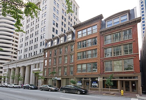
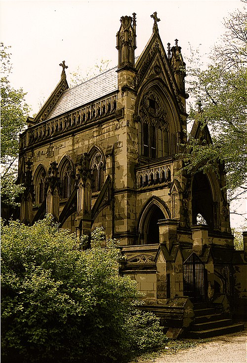
Some of the country's most noteable architects helped create the Hamilton County places including John Nolen, Adolph Strauch, Daniels,Howard; Salway,William, Frederick W. Garber, James Jones, Charles Duhme, Hannaford,Samuel, & Sons, Samuel Hannaford, Elzner & Anderson and Wilbur M. and Lee P. Firth. Prominent architectural styles found in Hamilton Country are Italianate, Greek Revival and Late Victorian.
Historic Significance:
Architecture/Engineering, Event
Architect, builder, or engineer:
Multiple
Architectural Style:
Mid 19th Century Revival, Late 19th And 20th Century Revivals, Late Victorian
Area of Significance:
Architecture, Transportation, Community Planning And Development
Period of Significance:
1875-1899, 1850-1874
Historic Function:
Domestic, Transportation
Historic Sub-function:
Rail-Related, Single Dwelling
Current Function:
Domestic, Transportation
Current Sub-function:
Rail-Related, Single Dwelling
The Glendale Historic District, designated as a National Historic Landmark in 1977, holds paramount national significance in the history of American urban planning as the first planned subdivision in the United States to utilize a curvilinear street pattern integrated with the natural topography. Platted in 1851 by civil engineer Robert Creighton Phillips for the Glendale Association, the village was envisioned as a picturesque, romantic refuge from the industrial clamor of nearby Cincinnati. Enabled by the newly constructed Cincinnati, Hamilton, and Dayton Railroad, Glendale pioneered the concept of the elite commuter railroad suburb. Its innovative design, which predates Frederick Law Olmsted's famous plan for Riverside, Illinois, rejected the traditional rigid gridiron pattern in favor of winding, tree-lined avenues that followed the undulating terrain, setting a profound precedent for suburban landscape design across the nation.
The district encompasses a remarkably preserved collection of mid-to-late 19th-century architecture that harmonizes with its carefully designed landscape. Spanning hundreds of acres, the village features an outstanding array of architectural styles popular during its formative years, including Gothic Revival, Italianate, Queen Anne, and Bracketed villas, many of which serve as stately residences set back on spacious, wooded lots. Complementing these residential treasures are historic civic, religious, and commercial structures, including the 1854 railroad depot. The enduring cohesion of Glendale's park-like setting, historic canopy of trees, and Victorian-era architecture continues to illustratively represent the mid-19th-century "suburban ideal" of romantic country living combined with urban accessibility.
Historic Significance:
Event
Area of Significance:
Community Planning And Development
Period of Significance:
1925-1949
Historic Function:
Commerce/Trade, Domestic, Education, Social
Historic Sub-function:
Civic, Multiple Dwelling, School, Single Dwelling, Specialty Store
Current Function:
Commerce/Trade, Domestic, Education, Religion
Current Sub-function:
Multiple Dwelling, Religious Structure, School, Single Dwelling, Specialty Store
The Greenhills Historic District, located in Hamilton County, Ohio, is nationally significant as one of only three "Greenbelt Towns" established by the federal government's Resettlement Administration during the New Deal era. Conceived under the direction of Rexford G. Tugwell and initiated in 1935, Greenhills was designed to address the dual crises of the Great Depression by providing modern, sanitary housing for low-to-moderate-income families and creating immediate construction jobs for the unemployed. Inspired by Ebenezer Howard's turn-of-the-century "Garden City" movement, the town's innovative layout integrated residential development with nature. It featured a protective encircling "greenbelt" of woodlands and agricultural fields, a pedestrian-friendly system of interior footpaths that separated foot traffic from automobile roadways, and a central community hub that concentrated commercial, educational, and civic services in a single walkable commons.
Architecturally, the district is defined by its original International Style and vernacular modern residences, designed by lead architect Roland A. Wank and town planner Justin R. Hartzog. Constructed between 1936 and 1938, the housing units-consisting of multi-family townhomes and modest single-family dwellings-emphasize functionalism and clean lines, utilizing durable materials like concrete block, brick, and redwood siding. Greenhills represents a pioneering American experiment in cooperative living and federal suburban planning, demonstrating a radical departure from traditional gridiron municipal layouts of the era. Designated a National Historic Landmark in addition to its listing on the National Register of Historic Places, the district remains an exceptionally preserved monument to mid-20th-century social engineering, economic relief efforts, and progressive urban design.
Historic Significance:
Architecture/Engineering
Architect, builder, or engineer:
Nolen,John
Architectural Style:
Greek Revival, Colonial
Area of Significance:
Community Planning And Development
Period of Significance:
1950-1974, 1925-1949, 1900-1924
Historic Function:
Commerce/Trade, Domestic
Historic Sub-function:
Business, Multiple Dwelling, Single Dwelling
Current Function:
Commerce/Trade, Domestic
Current Sub-function:
Business, Multiple Dwelling, Single Dwelling
The Mariemont Historic District, located in Hamilton County, Ohio, is nationally significant as one of the most highly realized and influential examples of the "Garden City" planning movement in the United States. Conceived in the 1920s by philanthropist Mary Emery as a "national exemplar" for planned communities, Mariemont was designed by the preeminent landscape architect and town planner John Nolen. Unlike the haphazard suburban sprawl of the era, Nolen's master plan seamlessly integrated residential, commercial, civic, and recreational zones with abundant green spaces, parks, and tree-lined boulevards. The community was intentionally designed to be walkable, self-contained, and socially diverse, featuring a wide range of housing options-from modest apartments and group houses to grand single-family homes-all situated within easy walking distance of the town center.
Architecturally, the district is celebrated for its cohesive yet diverse collection of early 20th-century historicist styles, with a heavy emphasis on English Tudor, Georgian, and Colonial Revival designs. To avoid monotony, Emery and Nolen commissioned twenty-six leading architects from across the country to design different sections of the town, resulting in a charming aesthetic reminiscent of an English country village. Key landmarks within the district include the Tudor-style Mariemont Inn, the stone-crafted non-denominational Memorial Church, and the scenic Mariemont Concourse overlooking the Little Miami River valley. Designated as a National Historic Landmark in 2007, the Mariemont Historic District stands as a remarkably intact testament to progressive urban planning and remains a premier touchstone for modern New Urbanism and smart-growth philosophies.
Historic Significance:
Architecture/Engineering
Architect, builder, or engineer:
Strauch,Adolph, Daniels,Howard; Salway,William
Architectural Style:
Gothic Revival
Area of Significance:
Landscape Architecture, Architecture
Period of Significance:
1875-1899, 1850-1874
Historic Function:
Funerary
Historic Sub-function:
Cemetery, Graves/Burials, Mortuary
Current Function:
Funerary
Current Sub-function:
Cemetery, Graves/Burials, Mortuary
Established in 1845 by the Cincinnati Horticultural Society, Spring Grove Cemetery is internationally recognized as the birthplace of the "landscape lawn" cemetery plan, a design philosophy that fundamentally transformed American funerary landscapes. Spanning over 700 acres, the cemetery was originally conceived in the rural cemetery tradition to address cholera outbreaks and the limitations of crowded urban churchyards. Its true historical significance emerged in 1855 with the appointment of Prussian landscape gardener Adolph Strauch as superintendent. Strauch revolutionized cemetery design by dismantling the cluttered family plot fences, hedges, and heavy grave markers typical of the era, replacing them with sweeping lawns, winding roads, scenic lakes, and carefully curated groupings of trees. His vision of a unified, park-like environment that harmonized nature and memorialization became the definitive prototype for modern cemeteries across the United States.
Beyond its pioneering landscape architecture, Spring Grove Cemetery is renowned as an exemplary botanical garden and a repository of outstanding nineteenth- and twentieth-century funerary art. The grounds feature an expansive arboretum of mature, exotic specimen trees alongside a magnificent collection of monuments and elaborate mausoleums designed by prominent architects in styles ranging from Gothic and Egyptian Revival to Neoclassical. Serving as the final resting place for numerous figures of national importance-including Civil War generals, industrial giants, and political leaders-Spring Grove stands as one of the most aesthetically influential and historically intact rural-style cemeteries in the nation, a legacy that secured its designation as a National Historic Landmark.